METHS
MULANJE EXPATRIATES THREEPEAKS
SOCIETY
HOME | NEWS | MEETS | REPORTS | MEMBERSHIP | CONTACT
MINI-METHS Rwanda. 6 – 16th August 2012
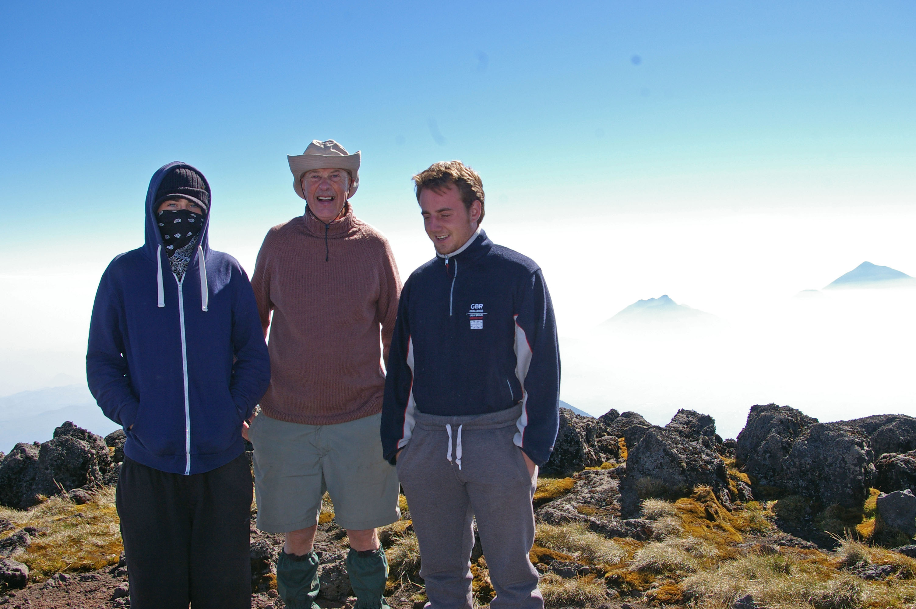
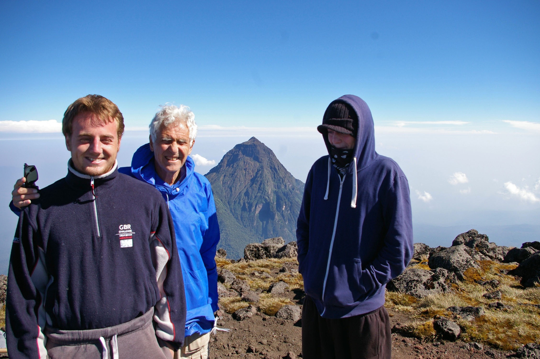
Participants: Rupert (West Face) Roschnik, David (Shooting
Stick) Leishman, Natan Cointet, Neil Cointet (non-member)
Summary
West Face
and 2 Cointets arrive in Kigali Friday
August 3rd already, having travelled overland from Zanzibar (ferries,
buses, minibuses, etc). Shooting Stick
arrives from the UK on Sunday 5th.
Monday 6th – visit Rwanda Development Board offices
(formerly ORTPN) to get Volcanoes National Park permits.
Tuesday 7th and Wednesday
8th – short walks (2-3 hrs) in hills to south and west of the city, incl. Mt Kigali, to acclimatise (1600-1850 m,
5250-6070 ft).
Thursday 9th – collect 4x4 vehicle, transfer to
Musanze (formerly Ruhengeri). Climb Mt Kabuye (2643 m, 8671 ft) from nr
Gakenke on the way. 950 m up and down
(ca 3100 ft). Round trip in about 4½
hrs. Mainly overcast, some fog and
drizzle. Many steep and muddy paths.
Friday 10th – explored Lake Burera area, then transferred
to Kinigi (2350 m, ca 7700 ft).
Saturday 11th – climbed Bisoke
(3711 m, 12175 ft), with crater
lake at the summit. 950 m up and down
(ca 3100 ft). Round trip in about 4
hrs. Mainly overcast, some fog at the
top. Steep and fairly muddy, slippery
path. One guide, one porter, armed
bodyguard of 5 soldiers.
Sunday 12th – climbed Muhabura
(4127 m, 13540 ft) (on Uganda border, small crater lake at the
summit). 1800 m up and down (ca 5900
ft). 4½ hrs up, 2 hrs down. Mainly sunny, some cloud. Tough, unrelentingly steep, mainly dry
path. One guide, 2 park rangers, 2
porters, armed bodyguard of 7 soldiers.
Monday 13th – rest day.
Tuesday 14th – up to camp at 3600 m (ca 11800 ft) on
Karisimbi. Had to take up our own tents
and camping gear. 1000 m up (ca 3300
ft), 3 hrs. Sunny. Pleasant path, mainly dry, some steep
sections. One guide, 4-5 porters (incl.
one for the guide) and 12 soldiers (one with a light machine gun). Also a solitary Frenchman with his own
porter.
Wednesday 15th – climbed Karisimbi
(4507 m, 14787 ft), 6th highest mountain in Africa. 900 m up (2950 ft), 2½ hrs. Beautiful day, distant views limited due to
dry-season haze. Continuously steep, dry
path. Then down again 1900 m (6230 ft),
collecting camping and other gear on the way (3½ hrs walking).
Thursday 16th – returned to Kigali, left the 4x4 vehicle,
flew back to Europe in the evening.
|
First close view of
Karisimbi on emerging from the forest |
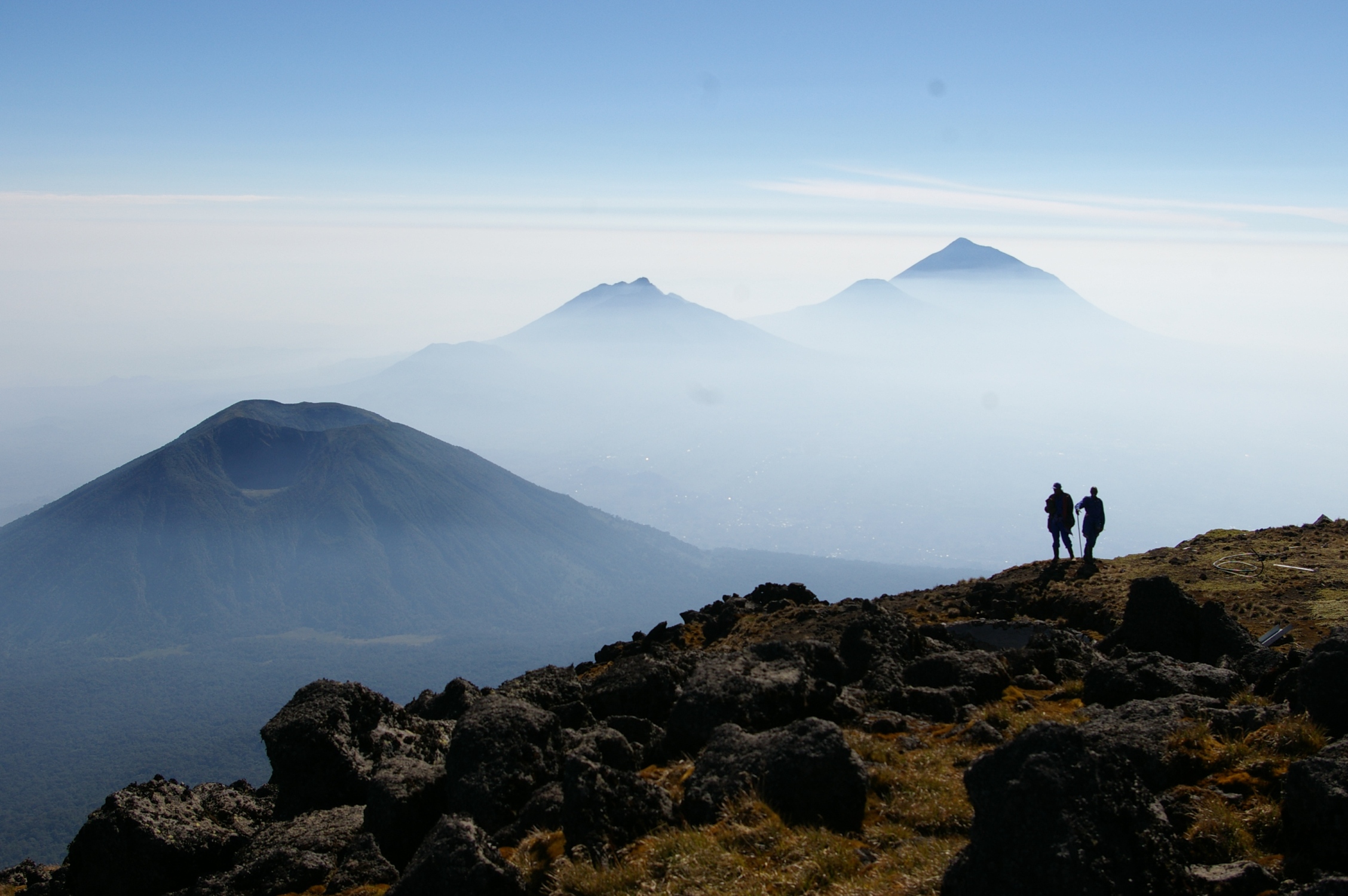
View from Karisimbi – Bisoke, Gahinga and
Muhabura (from left to right) |
Detailed report
Our objective was the Volcanoes National Park in Rwanda, which spans
part of its border with the Congo (DRC) and Uganda. It has a row of five extinct volcanoes,
strung along a range some 30 km (20 miles) long, and our plan was to climb
three of them, including the highest, Karisimbi, 4507 m (14'787 ft) high.
We all met at the Iris Guest House in Kigali on Sunday August 5th. Three of us had arrived from Tanzania a
couple of days earlier, Shooting Stick came directly from London via
Amsterdam. He had asked the hotel to
send transport to the airport but of course there was nothing there – Sunday
was the hotel manager's day off and he forgot to tell his deputy to tell the
driver …
Monday 6th we all took a taxi to the National
Parks office and organised our permits for climbing the volcanoes. Fortunately we had an e-mail exchange with
them previously so all went quite smoothly, but it was still quite a costly
business for the 4 of us, all payable in USD.
Then we went to the city centre, some 20 minutes walk from the guest
house, to change money, buy food, etc.
The centre is on a hill, well laid out with a large number of new
buildings, mainly banks. The commercial
area lies just below, a few streets with small shops as anywhere else in
Africa. The actual market was further
away. We looked for postcards but they
were not to be found in any hotel, supermarket or shop. Then somebody suggested the Post Office. Indeed, they sold postcards as well as stamps
– very logical – although the choice was limited, mainly pictures of gorillas.
We needed to do a couple of training walks and our first target was Mt
Kigali (1850 m, 6070 ft), suggested by the guide book. Hardly a mountain, more a long ridge. A short taxi ride took us to the foot,
already at 1600 m (5250 ft), from where we found our way up steeply between
high density housing until we entered a forest area where there were no more
buildings. The top was quite flat and we
never really got to the summit – which was in any case inaccessible because
surrounded by a military camp. But we
managed to hike a long way on a sort of road that followed the ridge. Three to
four children followed us most of the way, trying to direct us onto better paths
and hoping for a tip but they eventually gave up. We passed one local bar which gave us beer
and a few minutes watching the Olympics.
The next day we did a similar walk to the east of the town but mainly
flat along a dusty road lined with new constructions, some belonging to
religious or missionary groups. That
evening the 4x4 we had reserved was delivered to us, on old Toyota Landcruiser
that worked fine but was somewhat awkward in having only two side doors instead
of four.

Thursday we loaded up the Landcruiser and
set off towards Ruhengeri (also called Musanze). Following a guide book suggestion, we stopped
near Gakunke to climb Mt Kabuye (2643 m, 8671 ft) which involved well over 3000
ft up, so gave a good training climb.
The description was confusing so we soon had to take the services of a
youth who led us towards the mist-shrouded summit. He clearly didn't quite know the right way,
so he persuaded a forestry worker to join us higher up. We reached the summit, overcast and foggy, in
less than 3 hours, where we were greeted by a very loud thunderclap that was
extremely close. There were no more and
it didn't rain. We were taken down a
different way, straight down on a very muddy and slippery path, as was
witnessed by the state of our legs and trousers when we got to the bottom. We continued to Ruhengeri where we installed
ourselves in the La Palme Hotel, ideal for a bath, washing clothes, etc. Also a reasonable dinner and more Olympics on
the TV.
The next day was spent sightseeing, first around Lake Burera, then to
the famous Virunga Lodge for an exorbitantly expensive drink. Although we had quite sunny weather, the
volcanoes we were aiming for remained covered in heavy cloud. Early afternoon, we settled into the Kinigi
Guest House, a fairly basic place catering mainly for backpackers but close to
the National Park Headquarters that was to be our meeting place the next
day. Most meals here we had to order well
in advance – delivery times for even simple meals were well over an hour!
We had strolled along to the Park HQ that afternoon but it was
deserted. Imagine our surprise the next
day at 7.30 a.m. to find the car park full of 4x4s and the whole garden area a
seething mass of people. Most as it
turned out were hoping to see gorillas.
Viewing these is clearly quite an attraction but the price of USD 750 a
day was way above our budget. Besides
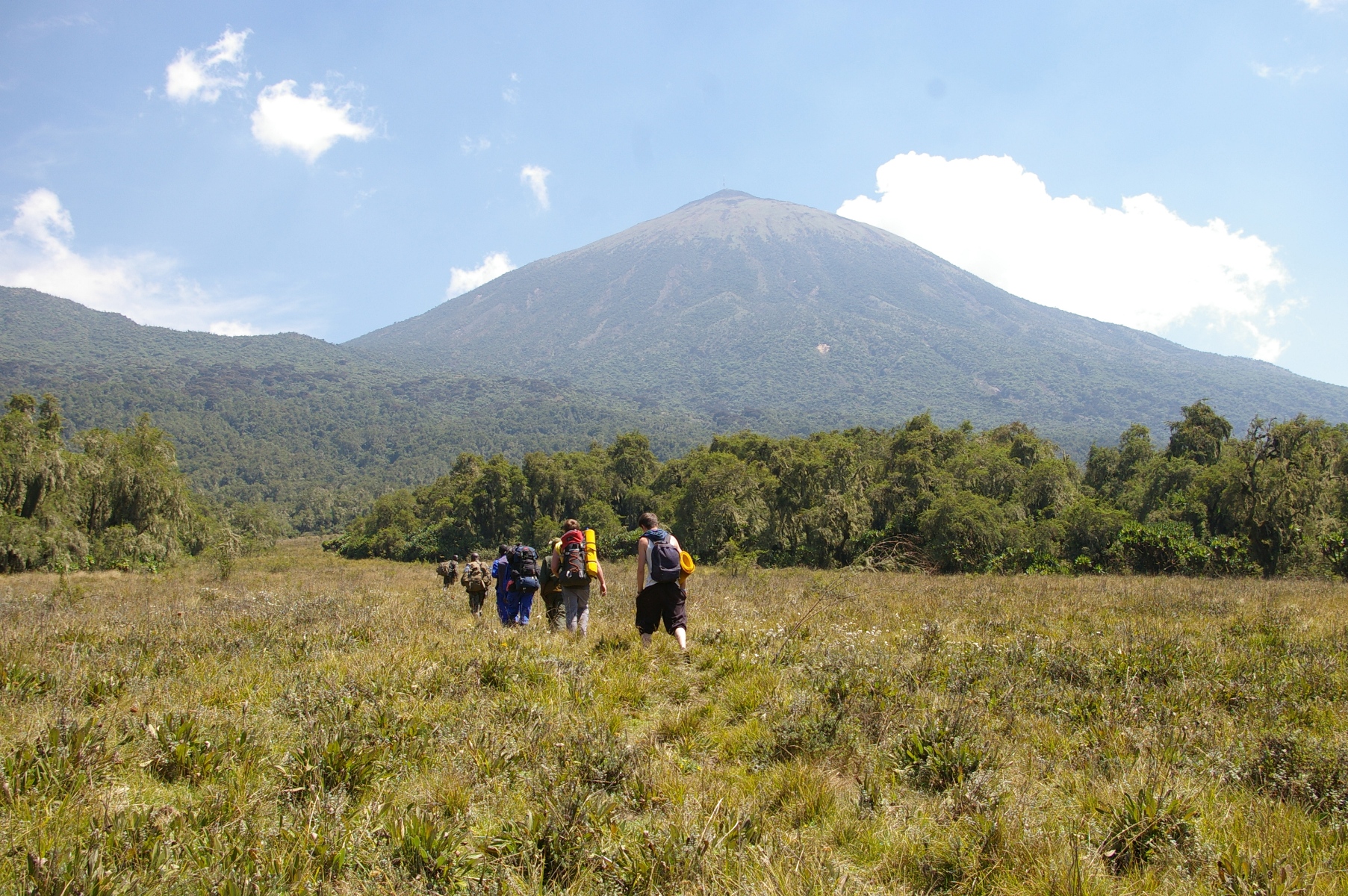
which, we were here to hike! We found
our guide, showed our vouchers and were soon on our way, after a short
briefing. We reached the trailhead in a
little under an hour, first on the main tarred road, then on steadily worsening
side roads, more like river beds or, better, lava flows than roads for long
stretches. This was supposed to be an
easy day, "only" up Bisoke, 3000 ft up, quite steep but still muddy
from the previous rains. Before entering
the Park, we were joined by the compulsory patrol of local askaris (soldiers). They were very smart in perfectly ironed
uniforms, all carried guns, but they were very discreet, walking in front or
behind and vanishing in the undergrowth whenever we stopped. We reached the crater lake at the summit in 2
½ hours. It was only partially visible
due to fog and mist, and we had no real view. So we descended again after a
picnic lunch. That evening, we got our
first clear view of Karisimbi, our main objective, above the clouds in the
west. In fact, the weather was slowly
improving.
Sunday 12th we were standing by the Landcruiser at 7.20 a.m., ready to
set off when a guide appeared to tell us we were already late and might not be
able to do Muhabura, 4127 m (13'540 ft) that day. It seems we were given the wrong starting
time by the office in Kigali. It was a
good hour to the trailhead and the side roads were quite pleasant after
yesterday's awful roads. We finally set
off just before 9 a.m. to attack the 1800 m (5850 ft) separating us from the
summit of Muhabura. Again, the narrow trail
went up steeply in the rain forest, but the path was mercifully quite dry. We used one porter that day and he was
certainly necessary. We left the forest
behind us after about 2 hours and had a short break a little later. It was now quite sunny, offering good views
down to the densely inhabited plain below us, but still cloudy on the Uganda
side. The rest of the climb became
progressively more tiring as we began to feel the altitude and stops with
gasping and panting for breath became more and more frequent, until we finally
reached the summit – with a small tarn at the top – by 1.30 p.m. Once again, there was mist at the summit, it
was cold and windy and there were no good views. The descent was of course much easier but I
found the part in the forest long and tedious, the loose black earth that
hadn't bothered us on the way up turned out slippery and treacherous on the way
down. It was already 6 p.m. by the time
we were all back at the vehicle and the drive back in the dark was quite
tricky, given the large numbers of pedestrians and cyclists all along the edges
of the road, almost invisible until one was right on top of them. In all, our longest and most tiring day.
Monday 13th was a well-earned rest day, spent visiting Ruhengeri (to
change money and buy food and cutlery for the next day), washing and drying out
socks, etc. By now, we had nice sunny
weather and clear views of all the mountains.
Finally, we were able to go for the highest volcano in the Virungas,
Karisimbi, 4507 m. It is a two-day trip,
with a camp about half way up at 3600 m.
Nothing is provided except guides and porters, so climbers must bring
tents and bedding, also all food and cooking equipment. We took a calculated risk and decided not to
take any camping stoves with us but live on sandwiches, biscuits, fruit,
breakfast cereal and milk, etc for the one night. So we met at the Park HQ at the appointed
time and drove to the same trailhead as on the first day. We were joined by a single Frenchman who had
his permit but no transport (in return, he gave us hot water in the camp, so we
got our hot drinks after all!) The first
day's walk was very pleasant, not too steep, through some beautiful
Hagenia-Hypericum forest and we reached the camp shortly after lunch, having
climbed some 1000 m. Here we organised
our tents and sleeping arrangements.
Shooting Stick did not bring a sleeping bag but had a survival bag that
had received a Duke of Edinburgh Award recommendation. In fact it was no more than a large plastic
bag, quite thick and bright orange, but with no insulating properties at
all. He told us the next morning he'd
spent a miserable night – the actual words used are however not fit to be
published, even in a METHS context! Neil
spurned the use of a tent and slept on the floor in the dining banda, on a mattress of a shrubby plant that grew all around
the camp. The 4-5 porters made a large
log fire in whose ashes they cooked potatoes and corn cobs, the soldiers –
there were 12 of them – made their own camps and camp fires some way above and
below ours. It had been a beautiful day
and now we had a fantastic clear and starry night, with no haze or light
pollution, but it was cold, around freezing.
Wednesday 15th was the big day.
The guide had persuaded us to get up at 5 a.m. and leave 30 minutes
later. But all was still pitch dark at 5
and getting up was a slow process. By
5.30 we were shivering and eating our breakfast of Weetabix and in the end left
at 6 a.m., by which time it was daylight.
The sun came over the horizon at 6.30 and we were soon stripping off our
outer layers of clothing. The path
continued up steeply through giant groundsel, then over grass when these ran
out and finally over stones and sandy volcanic ash. We each went at our own pace and reached the
summit between 8.30 and 9. It was worth
the effort! A beautifully sunny day with
good views to the neighbouring mountains, notably the whole Virunga volcano
chain to the north, Mikeno (4437 m, 14557 ft) in the Congo (DRC) only about 5
km away to the west and, further away, the two active volcanoes in the Congo –
Nyiragongo and Nyamuragira, both with steam/white smoke coming out of their
summit craters. The view down onto the
plain was limited by haze; it was just
possible to make out where Goma was situated but Lake Kivu remained
invisible. On the downside, there is a
huge TV mast close to the summit, a few aluminium sheds and a shocking amount
of building rubbish – cables, wire, metal girders, broken glass, wood, etc –
not a pretty sight for a National Park!
|
|
|
We started down at about 9.30, rested at the camp and packed up all our
gear, then continued down to the Landcruiser, where we paid off the porters and
the (compulsory) guardian of our vehicle.
Back to the Guest House for beer and showers.
August 16th we returned to Kigali, had lunch at the Chez Robert
restaurant and hung out at the luxurious Mille Collines hotel; we later returned the 4x4 and were taken to
the airport for the night flight back to Europe.
© WDYFO, 2012